Warning
This specification is not final and is subject to change.
Referencing (ISO 19111)
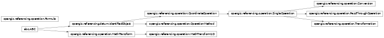
Coordinate Operation
-
class
opengis.referencing.operation.Conversion An operation on coordinates that does not include any change of Datum.
-
abstract property
operation_version This attribute is declared in
CoordinateOperationbut is not used in a conversion.
-
property
source_crs Returns the source CRS. Conversions may have a source CRS that is not specified here, but through
GeneralDerivedCRS.getBaseCRS()instead.- Returns
The source CRS, or null if not available.
- Return type
-
property
target_crs Returns the target CRS. Conversions may have a target CRS that is not specified here, but through
GeneralDerivedCRSinstead.- Returns
The target CRS, or null if not available.
- Return type
-
abstract property
-
class
opengis.referencing.operation.CoordinateOperation A mathematical operation on coordinates that transforms or converts coordinates to another coordinate reference system.
-
property
coordinate_operation_accuracy Estimate(s) of the impact of this operation on point accuracy. Gives position error estimates for target coordinates of this coordinate operation, assuming no errors in source coordinates.
- Returns
The position error estimates, or an empty collection if not available.
- Return type
Sequence[PositionalAccuracy]
-
property
domain_of_validity Area or region or timeframe in which this coordinate operation is valid.
- Returns
The coordinate operation valid domain, or null if not available.
- Return type
-
property
math_transform Gets the math transform. The math transform will transform positions in the source coordinate reference system into positions in the target coordinate reference system. It may be null in the case of defining conversions.
- Returns
The transform from source to target CRS, or null if not applicable.
- Return type
-
property
operation_version Version of the coordinate transformation (i.e., instantiation due to the stochastic nature of the parameters). Mandatory when describing a transformation, and should not be supplied for a conversion.
- Returns
The coordinate operation version, or null in none.
- Return type
str
-
abstract property
scope Description of domain of usage, or limitations of usage, for which this operation is valid.
- Returns
A description of domain of usage.
- Return type
str
-
property
source_crs Returns the source CRS. The source CRS is mandatory for transformations only. Conversions may have a source CRS that is not specified here, but through
GeneralDerivedCRS.getBaseCRS()instead.- Returns
The source CRS, or null if not available.
- Return type
-
property
target_crs Returns the target CRS. The target CRS is mandatory for transformations only. Conversions may have a target CRS that is not specified here, but through
GeneralDerivedCRSinstead.- Returns
The target CRS, or null if not available.
- Return type
-
property
-
class
opengis.referencing.operation.Formula Specification of the coordinate operation method formula.
-
property
citation Reference to a publication giving the formula(s) or procedure used by the coordinate operation method.
- Returns
Reference to a publication giving the formula, or null if none.
- Return type
-
property
formula Formula(s) or procedure used by the operation method.
- Returns
The formula used by the operation method, or null if none.
- Return type
str
-
property
-
class
opengis.referencing.operation.MathTransform Transforms multi-dimensional coordinate points.
-
derivative(point: opengis.geometry.primitive.DirectPosition) → numpy.ndarray Gets the derivative of this transform at a point. The derivative is the matrix of the non-translating portion of the approximate affine map at the point. The matrix will have dimensions corresponding to the source and target coordinate systems.
- Parameters
point (DirectPosition) – The coordinate point where to evaluate the derivative. Null value is accepted only if the derivative is the same everywhere (e.g. with affine transforms). But most map projection will requires a non-null value.
- Returns
The derivative at the specified point (never null).
- Return type
numpy.ndarray
-
abstract
inverse() Creates the inverse transform of this object. This method may fail if the transform is not one to one.
- Returns
The inverse transform.
- Return type
-
abstract property
is_identity Tests whether this transform does not move any points.
- Returns
True if this MathTransform is an identity transform; false otherwise.
- Return type
bool
-
abstract property
source_dimensions Gets the dimension of input points.
- Returns
The dimension of input points.
- Return type
int
-
abstract property
target_dimensions Gets the dimension of output points.
- Returns
The dimension of output points.
- Return type
int
-
abstract
to_wkt() → str Returns a Well Known Text (WKT) for this object. Well know text are defined in extended Backus Naur form. This operation may fails if an object is too complex for the WKT format capability.
- Returns
The Well Known Text (WKT) for this object.
- Return type
str
-
transform(pt_src: opengis.geometry.primitive.DirectPosition, pt_dst: opengis.geometry.primitive.DirectPosition) → opengis.geometry.primitive.DirectPosition Transforms the specified ptSrc and stores the result in ptDst.
- Parameters
pt_src (DirectPosition) – the specified coordinate point to be transformed.
pt_dst (DirectPosition) – the specified coordinate point that stores the result of transforming ptSrc, or null.
- Returns
the coordinate point after transforming ptSrc and storing the result in ptDst, or a newly created point if ptDst was null.
- Return type
-
transform_list(src_pts: numpy.ndarray, src_off: int, dst_pts: numpy.ndarray, dst_off: int, num_pts: int) Transforms a list of coordinate point ordinal values. This method is provided for efficiently transforming many points. The supplied array of ordinal values will contain packed ordinal values. For example, if the source dimension is 3, then the ordinals will be packed in this order: (x0,y0,z0, x1,y1,z1 …).
- Parameters
src_pts (numpy.ndarray) – the array containing the source point coordinates.
src_off (int) – the offset to the first point to be transformed in the source array.
dst_pts (numpy.ndarray) – the array into which the transformed point coordinates are returned. May be the same than srcPts
dst_off (int) – the offset to the location of the first transformed point that is stored in the destination
num_pts (int) – the number of point objects to be transformed.
-
-
class
opengis.referencing.operation.MathTransform1D Transforms one-dimensional coordinate points.
-
derivative(value: float) → float Gets the derivative of this function at a value. The derivative is the 1×1 matrix of the non-translating portion of the approximate affine map at the value.
- Parameters
value (float) – The value where to evaluate the derivative.
- Returns
The derivative at the specified point.
- Return type
float
-
abstract
inverse() Creates the inverse transform of this object.
- Returns
The inverse transform.
- Return type
-
transform_value(value: float) → float Transforms the specified value.
- Parameters
value (float) – The value to transform.
- Returns
the transformed value.
- Return type
float
-
-
class
opengis.referencing.operation.OperationMethod Definition of an algorithm used to perform a coordinate operation.
-
abstract property
formula Formula(s) or procedure used by this operation method. This may be a reference to a publication. Note that the operation method may not be analytic, in which case this attribute references or contains the procedure, not an analytic formula.
- Returns
The formula used by this method.
- Return type
-
abstract property
parameters The set of parameters.
- Returns
The parameters, or an empty group if none.
- Return type
ParameterDescriptorGroup
-
abstract property
-
class
opengis.referencing.operation.PassThroughOperation A pass-through operation specifies that a subset of a coordinate tuple is subject to a specific coordinate operation.
-
abstract property
modified_coordinates Ordered sequence of positive integers defining the positions in a coordinate tuple of the coordinates affected by this pass-through operation.
- Returns
The modified coordinates.
- Return type
Sequence[int]
-
abstract property
operation Returns the operation to apply on the subset of a coordinate tuple.
- Returns
The operation to apply on the subset of a coordinate tuple.
- Return type
-
abstract property
-
class
opengis.referencing.operation.SingleOperation A parameterized mathematical operation on coordinates that transforms or converts coordinates to another coordinate reference system.
-
abstract property
method Returns the operation method.
- Returns
The operation method.
- Return type
-
abstract property
parameter_values Returns the parameter values.
- Returns
The parameters values.
- Return type
ParameterValueGroup
-
abstract property
-
class
opengis.referencing.operation.Transformation An operation on coordinates that usually includes a change of Datum.
-
abstract property
operation_version Version of the coordinate transformation (i.e., instantiation due to the stochastic nature of the parameters). This attribute is mandatory in a Transformation.
- Returns
The coordinate operation version.
- Return type
str
-
abstract property
source_crs Returns the source CRS
- Returns
The source CRS (never null).
- Return type
-
abstract property
target_crs Returns the target CRS.
- Returns
The target CRS (never null)
- Return type
-
abstract property
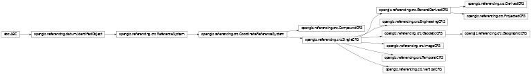
Coordinate Reference System
-
class
opengis.referencing.crs.CompoundCRS A coordinate reference system describing the position of points through two or more independent coordinate reference systems.
-
abstract property
components The ordered list of coordinate reference systems.
- Returns
The ordered list of coordinate reference systems.
- Return type
Sequence[SingleCRS]
-
abstract property
-
class
opengis.referencing.crs.CoordinateReferenceSystem Abstract coordinate reference system, usually defined by a coordinate system and a datum.
-
class
opengis.referencing.crs.DerivedCRS A coordinate reference system that is defined by its coordinate conversion from another coordinate reference system but is not a projected coordinate reference system.
-
class
opengis.referencing.crs.EngineeringCRS A contextually local coordinate reference system.
-
abstract property
datum Returns the datum, which must be an engineering one.
- Returns
The datum
- Return type
-
abstract property
-
class
opengis.referencing.crs.GeneralDerivedCRS A coordinate reference system that is defined by its coordinate conversion from another coordinate reference system (not by a datum).
-
abstract property
base_crs Returns the base coordinate reference system.
- Returns
The base coordinate reference system.
- Return type
-
abstract property
conversion_from_base Returns the conversion from the base CRS to this CRS.
- Returns
The conversion from the base CRS.
- Return type
-
abstract property
-
class
opengis.referencing.crs.GeodeticCRS A coordinate reference system associated with a geodetic datum.
-
abstract property
datum Returns the datum, which must be geodetic.
- Returns
The datum.
- Return type
-
abstract property
-
class
opengis.referencing.crs.GeographicCRS A coordinate reference system based on an ellipsoidal approximation of the geoid; this provides an accurate representation of the geometry of geographic features for a large portion of the earth’s surface.
-
abstract property
coordinate_system Returns the coordinate system, which must be ellipsoidal.
- Returns
The coordinate system.
- Return type
-
abstract property
-
class
opengis.referencing.crs.ImageCRS An engineering coordinate reference system applied to locations in images.
-
abstract property
coordinate_system Returns the cartesian coordinate system.
- Returns
The coordinate system.
- Return type
-
abstract property
datum Returns the datum, which must be an image one.
- Returns
The datum
- Return type
-
abstract property
-
class
opengis.referencing.crs.ProjectedCRS A 2D coordinate reference system used to approximate the shape of the earth on a planar surface.
-
abstract property
base_crs Returns the base coordinate reference system, which must be geographic.
- Returns
The base coordinate reference system.
- Return type
-
abstract property
conversion_from_base Returns the map projection from the base CRS to this CRS.
- Returns
The conversion from the base CRS.
- Return type
-
abstract property
coordinate_system Returns the coordinate system, which must be cartesian.
- Returns
The coordinate system.
- Return type
-
abstract property
datum Returns the datum.
- Returns
The datum.
- Return type
-
abstract property
-
class
opengis.referencing.crs.ReferenceSystem Description of a spatial and temporal reference system used by a dataset.
-
property
domain_of_validity Area or region or timeframe in which this (coordinate) reference system is valid.
- Returns
The reference system valid domain, or null if not available.
- Return type
-
property
scope Description of domain of usage, or limitations of usage, for which this Reference System object is valid.
- Returns
The domain of usage, or null if none.
- Return type
str
-
property
-
class
opengis.referencing.crs.SingleCRS Abstract coordinate reference system, consisting of a single Coordinate System and a single Datum.
-
abstract property
coordinate_system Returns the coordinate system.
- Returns
The coordinate system.
- Return type
-
abstract property
datum Returns the datum.
- Returns
The datum
- Return type
-
abstract property
-
class
opengis.referencing.crs.TemporalCRS A 1D coordinate reference system used for the recording of time.
-
abstract property
coordinate_system Returns the coordinate system, which must be temporal.
- Returns
The coordinate system.
- Return type
-
abstract property
datum Returns the datum, which must be temporal.
- Returns
The datum
- Return type
-
abstract property
-
class
opengis.referencing.crs.VerticalCRS A 1D coordinate reference system used for recording heights or depths.
-
abstract property
coordinate_system Returns the coordinate system, which must be vertical.
- Returns
The coordinate system.
- Return type
-
abstract property
datum Returns the datum, which must be vertical.
- Returns
The datum
- Return type
-
abstract property
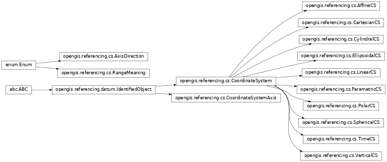
Coordinate System
-
class
opengis.referencing.cs.AffineCS A 2- or 3-dimensional coordinate system with straight axes that are not necessarily orthogonal.
-
class
opengis.referencing.cs.AxisDirection The direction of positive increase in the coordinate value for a coordinate system axis. This direction is exact in some cases, and is approximate in other cases.
-
COLUMN_NEGATIVE= 'columnNegative'
-
COLUMN_POSITIVE= 'columnPositive'
-
DISPLAY_DOWN= 'displayDown'
-
DISPLAY_LEFT= 'displayLeft'
-
DISPLAY_RIGHT= 'displayRight'
-
DISPLAY_UP= 'displayUp'
-
DOWN= 'down'
-
EAST= 'east'
-
EAST_NORTH_EAST= 'eastNorthEast'
-
EAST_SOUTH_EAST= 'eastSouthEast'
-
FUTURE= 'future'
-
GEOCENTRIC_X= 'geocentricX'
-
GEOCENTRIC_Y= 'geocentricY'
-
GEOCENTRIC_Z= 'geocentricZ'
-
NORTH= 'north'
-
NORTH_EAST= 'northEast'
-
NORTH_NORTH_EAST= 'northNorthEast'
-
NORTH_NORTH_WEST= 'northNorthWest'
-
NORTH_WEST= 'northWest'
-
OTHER= 'other'
-
PAST= 'past'
-
ROW_NEGATIVE= 'rowNegative'
-
ROW_POSITIVE= 'rowPositive'
-
SOUTH= 'south'
-
SOUTH_EAST= 'southEast'
-
SOUTH_SOUTH_EAST= 'southSouthWest'
-
SOUTH_SOUTH_WEST= 'southSouthWest'
-
SOUTH_WEST= 'southWest'
-
UP= 'up'
-
WEST= 'west'
-
WEST_NORTH_WEST= 'westNorthWest'
-
WEST_SOUTH_WEST= 'westSouthWest'
-
-
class
opengis.referencing.cs.CartesianCS A 2- or 3-dimensional coordinate system with orthogonal straight axes. All axes shall have the same length unit of measure.
-
class
opengis.referencing.cs.CoordinateSystem The set of coordinate system axes that spans a given coordinate space. A coordinate system (CS) is derived from a set of (mathematical) rules for specifying how coordinates in a given space are to be assigned to points. The coordinate values in a coordinate tuple shall be recorded in the order in which the coordinate system axes associations are recorded, whenever those coordinates use a coordinate reference system that uses this coordinate system.
-
abstract
axis(dimension: int) → opengis.referencing.cs.CoordinateSystemAxis Returns the axis for this coordinate system at the specified dimension.
- Parameters
dimension (int) – The zero based index of axis.
- Returns
The axis at the specified dimension.
- Return type
-
abstract property
dimension Returns the dimension of the coordinate system.
- Returns
The dimension of the coordinate system.
- Return type
int
-
abstract
-
class
opengis.referencing.cs.CoordinateSystemAxis Definition of a coordinate system axis.
-
abstract property
abbreviation The abbreviation used for this coordinate system axes. This abbreviation is also used to identify the ordinates in coordinate tuple.
- Returns
The coordinate system axis abbreviation.
- Return type
int
-
abstract property
direction Direction of this coordinate system axis.
- Returns
The coordinate system axis direction.
- Return type
-
property
maximum_value Returns the maximum value normally allowed for this axis, in the unit of measure for the axis. If there is no maximum value, then this method returns positive infinity.
- Returns
The maximum value, or the positive infinity if none.
- Return type
float
-
property
minimum_value Returns the minimum value normally allowed for this axis, in the unit of measure for the axis. If there is no minimum value, then this method returns negative infinity.
- Returns
The minimum value, or the negative infinity if none.
- Return type
float
-
property
range_meaning Returns the meaning of axis value range specified by the minimum and maximum values. This element shall be omitted when both minimum and maximum values are omitted. It may be included when minimum and/or maximum values are included. If this element is omitted when minimum or maximum values are included, the meaning is unspecified
- Returns
The range meaning, or null in none.
- Return type
-
abstract property
unit Returns the unit of measure used for this coordinate system axis. The value of a coordinate in a coordinate tuple shall be recorded using this unit of measure, whenever those coordinates use a coordinate reference system that uses a coordinate system that uses this axis.
- Returns
The coordinate system axis unit.
-
abstract property
-
class
opengis.referencing.cs.CylindralCS A 3-dimensional coordinate system consisting of a PolarCS extended by a straight axis perpendicular to the plane spanned by the polar CS.
-
class
opengis.referencing.cs.EllipsoidalCS A 2- or 3-dimensional coordinate system in which position is specified by geodetic latitude, geodetic longitude, and (in the 3D case) ellipsoidal height.
-
class
opengis.referencing.cs.LinearCS A 1-dimensional coordinate system that consists of the points that lie on the single axis described. The associated coordinate is the distance – with or without offset – from the origin point, specified through the datum definition, to the point along the axis.
-
class
opengis.referencing.cs.ParametricCS A 1-dimensional coordinate system containing a single axis. This coordinate system uses parameter values or functions to describe the position of a point.
-
class
opengis.referencing.cs.PolarCS A 2-dimensional coordinate system in which position is specified by the distance from the origin and the angle between the line from the origin to a point and a reference direction.
-
class
opengis.referencing.cs.RangeMeaning Meaning of the axis value range specified through minimum value and maximum value.
-
EXACT= 'exact'
-
WRAPAROUND= 'wraparound'
-
-
class
opengis.referencing.cs.SphericalCS A 3-dimensional coordinate system with one distance measured from the origin and two angular coordinates. Not to be confused with an EllipsoidalCS based on an ellipsoid “degenerated” into a sphere.
-
class
opengis.referencing.cs.TimeCS A 1-dimensional coordinate system containing a single time axis. This coordinate system is used to describe the temporal position of a point in the specified time units from a specified time origin.
-
class
opengis.referencing.cs.VerticalCS A 1-dimensional coordinate system used to record the heights or depths of points. Such a coordinate system is usually dependent on the Earth’s gravity field, perhaps loosely as when atmospheric pressure is the basis for the vertical coordinate system axis. An exact definition is deliberately not provided as the complexities of the subject fall outside the scope of the ISO 19111 specification.
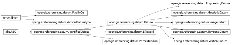
Datum
-
class
opengis.referencing.datum.Datum Specifies the relationship of a coordinate system to the earth, thus creating a coordinate reference system.
-
property
anchor_point Description, possibly including coordinates, of the point or points used to anchor the datum to the Earth.
-
property
domain_of_validity Information about spatial, vertical, and temporal extent. This interface has four optional attributes (geographic elements, temporal elements, and vertical elements) and an element called description. At least one of the four shall be used.
-
property
realization_epoch The time after which this datum definition is valid.
-
property
scope Description of domain of usage, or limitations of usage, for which this datum object is valid.
-
property
-
class
opengis.referencing.datum.Ellipsoid Geometric figure that can be used to describe the approximate shape of the earth.
-
property
axis_unit Linear unit of the semi-major and semi-minor axis values.
-
abstract property
inverse_flattering Value of the inverse of the flattening constant.
-
abstract property
is_inf_definitive Indicates if the inverse flattening is definitive for this ellipsoid. Some ellipsoids use the IVF as the defining value, and calculate the polar radius whenever asked. Other ellipsoids use the polar radius to calculate the IVF whenever asked. This distinction can be important to avoid floating-point rounding errors.
-
abstract property
is_sphere true if the ellipsoid is degenerate and is actually a sphere. The sphere is completely defined by the semi-major axis, which is the radius of the sphere.
-
abstract property
semi_major_axis Length of the semi-major axis of the ellipsoid. This is the equatorial radius in axis linear unit.
-
abstract property
semi_minor_axis Length of the semi-minor axis of the ellipsoid. This is the polar radius in axis linear unit.
-
property
-
class
opengis.referencing.datum.EngineeringDatum Defines the origin of an engineering coordinate reference system.
-
class
opengis.referencing.datum.GeodeticDatum Defines the location and precise orientation in 3-dimensional space of a defined ellipsoid (or sphere) that approximates the shape of the earth.
-
abstract property
ellipsoid Returns the ellipsoid.
-
abstract property
prime_meridian Returns the prime meridian.
-
abstract property
-
class
opengis.referencing.datum.IdentifiedObject Identification and remarks information for a reference system or CRS-related object.
-
abstract property
name The primary name by which this object is identified.
- Returns
The primary name.
- Return type
-
property
remarks Comments on or information about this object, including data source information.
- Returns
The remarks, or None.
- Return type
str
-
abstract
to_wkt() → str Returns a Well-Known Text (WKT) for this object.
- Returns
The Well Know Text for this object.
- Return type
str
-
abstract property
-
class
opengis.referencing.datum.ImageDatum Defines the origin of an image coordinate reference system.
-
abstract property
pixel_in_cell Specification of the way the image grid is associated with the image data attributes.
-
abstract property
-
class
opengis.referencing.datum.PixelInCell Specification of the way the image grid is associated with the image data attributes.
-
CELL_CENTER= 'cellCenter'
-
CELL_CORNER= 'cellCorner'
-
-
class
opengis.referencing.datum.PrimeMeridian A prime meridian defines the origin from which longitude values are determined.
-
abstract property
angular_unit Returns the angular unit of the Greenwich longitude.
-
abstract property
greenwich_longitude Longitude of the prime meridian measured from the Greenwich meridian, positive eastward.
-
abstract property
-
class
opengis.referencing.datum.TemporalDatum A temporal datum defines the origin of a temporal coordinate reference system.
-
abstract property
anchor_point This attribute is defined in the Datum parent interface, but is not used by a temporal datum.
-
abstract property
origin The date and time origin of this temporal datum.
-
abstract property
realization_epoch This attribute is defined in the Datum parent interface, but is not used by a temporal datum.
-
abstract property
-
class
opengis.referencing.datum.VerticalDatum A textual description and/or a set of parameters identifying a particular reference level surface used as a zero-height surface.
-
abstract property
vertical_datum_type The type of this vertical datum.
-
abstract property
-
class
opengis.referencing.datum.VerticalDatumType Type of a vertical datum.
-
BAROMETRIC= 'barometric'
-
DEPTH= 'depth'
-
GEOIDAL= 'geoidal'
-
OTHER_SURFACE= 'otherSurface'
-