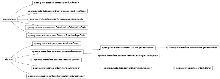
Warning

This specification is not final and is subject to change.

Naming (ISO 19103)

Inheritance diagram of opengis.metadata.naming
class opengis.metadata.naming.GenericName
abstract property depth
abstract property parsed_name
abstract property scope
class opengis.metadata.naming.LocalName
abstract property a_name
abstract property parsed_name
class opengis.metadata.naming.MemberName
abstract property a_name
abstract property attribute_type
class opengis.metadata.naming.NameSpace
abstract property is_global
abstract property name
class opengis.metadata.naming.Record
abstract property member_value
property record_type
class opengis.metadata.naming.RecordSchema
abstract property description
abstract property schema_name
class opengis.metadata.naming.RecordType
abstract property member_types
abstract property schema
abstract property type_name
class opengis.metadata.naming.ScopedName
abstract property head
abstract property scoped_name
abstract property tail
class opengis.metadata.naming.Type
abstract property type_name
class opengis.metadata.naming.TypeName
abstract property a_name

Metadata (ISO 19115)

Base

Inheritance diagram of opengis.metadata.base
class opengis.metadata.base.Metadata

Root entity which defines metadata about a resource or resources.

property acquisition_information

Information about the acquisition of the data.

property alternative_metadata_reference

Unique Identifier and onlineResource for alternative metadata.

property application_schema_info

Information about the conceptual schema of a dataset.

abstract property contact

Party responsible for the metadata information.

property content_info

Information about the feature and coverage characteristics.

property data_quality_info

Overall assessment of quality of a resource(s).

abstract property date_info

Date(s) other than creation date. Example: expiry date.

property default_locale

Provides information about an alternatively used localized character string for a linguistic extension.

property distribution_info

Information about the distributor of and options for obtaining the resource(s).

abstract property identification_info

Basic information about the resource(s) to which the metadata applies.

property metadata_constraints

Restrictions on the access and use of metadata.

property metadata_extension_info

Information describing metadata extensions.

property metadata_identifier

Unique identifier for this metadata record.

property metadata_linkage

Online location where the metadata is available.

property metadata_maintenance

Information about the frequency of metadata updates, and the scope of those updates.

property metadata_profile

Citation(s) for the profile(s) of the metadata standard to which the metadata conform.

property metadata_scope

The scope or type of resource for which metadata is provided.

property metadata_standard

Citation for the standards to which the metadata conforms.

property parent_metadata

Identifier and onlineResource for a parent metadata record.

property portrayal_catalogue_info

Information about the catalogue of rules defined for the portrayal of a resource(s).

property reference_system_info

Description of the spatial and temporal reference systems used in the dataset. The reference system may be:

  • An ISO 19111 object such as CoordinateReferenceSystem.

  • A ReferenceSystem with the identifier property (from ISO 19111) sets to a list of Identifier values such as ["EPSG::4326"].

  • An object with the referenceSystemIdentifier property (from ISO 19115) sets to a single Identifier value such as "EPSG::4326", optionally with a referenceSystemType property sets to a value such as geodeticGeographic2D or compoundProjectedTemporal.

Return type

Sequence[ReferenceSystem]

property resource_lineage

Information about the provenance, sources and/or the production processes applied to the resource.

property spatial_representation_info

Digital representation of spatial information in the dataset.

class opengis.metadata.base.MetadataScope
property name
abstract property resource_scope
class opengis.metadata.base.PortrayalCatalogueReference

Information identifying the portrayal catalogue used.

abstract property portrayal_catalogue_citation

Bibliographic reference to the portrayal catalogue cited.

Citation

Inheritance diagram of opengis.metadata.citation
class opengis.metadata.citation.Address

Location of the responsible individual or organisation.

property administrative_area

State, province of the location.

property city

City of the location.

property country

Country of the physical address.

property delivery_point

Address line for the location (as described in ISO 11180, Annex A).

property electronic_mail_address

Address of the electronic mailbox of the responsible organisation or individual.

property postal_code

ZIP or other postal code.

class opengis.metadata.citation.Citation

Standardized resource reference.

property ISBN

International Standard Book Number.

property ISSN

International Standard Serial Number.

property alternate_title

Short name or other language name by which the cited information is known. Example: DCW as an alternative title for Digital Chart of the World.

property cited_responsible_party

Name and position information for an individual or organisation that is responsible for the resource.

property date

Reference date for the cited resource.

property edition

Version of the cited resource.

property edition_date

Date of the edition.

property graphic

Citation graphic or logo for cited party.

property identifier

Value uniquely identifying an object within a namespace.

property online_resource

Online reference to the cited resource.

property other_citation_details

Other information required to complete the citation that is not recorded elsewhere.

property presentation_form

Mode in which the resource is represented.

property series

Information about the series, or aggregate resource, of which the resource is a part.

abstract property title

Name by which the cited resource is known.

class opengis.metadata.citation.Contact

Information required to enable contact with the responsible person and/or organisation.

property address

Physical and email address at which the organisation or individual may be contacted.

property contact_instructions

Supplemental instructions on how or when to contact the individual or organisation.

property contact_type
property hours_of_service

Time period (including time zone) when individuals can contact the organisation or individual.

property online_resource

On-line information that can be used to contact the individual or organisation.

property phone

Telephone numbers at which the organisation or individual may be contacted.

class opengis.metadata.citation.Date

Reference date and event used to describe it.

abstract property date

Reference date for the cited resource.

abstract property date_type

Event used for reference date.

class opengis.metadata.citation.DateTypeCode

An enumeration.

ADOPTED = 'adopted'
CREATION = 'creation'
DEPRECATED = 'deprecated'
DISTRIBUTION = 'distribution'
EXPIRY = 'expiry'
IN_FORCE = 'inForce'
LAST_REVISION = 'lastRevision'
LAST_UPDATE = 'lastUpdate'
NEXT_UPDATE = 'nextUpdate'
PUBLICATION = 'publication'
RELEASED = 'released'
REVISION = 'revision'
SUPERSEDED = 'superseded'
UNAVAILABLE = 'unavailable'
VALIDITY_BEGINS = 'validityBegins'
VALIDITY_EXPIRES = 'validityExpires'
class opengis.metadata.citation.Identifier

Value uniquely identifying an object within a namespace.

property authority

Citation for the code namespace and optionally the person or party responsible for maintenance of that namespace.

abstract property code

Alphanumeric value identifying an instance in the namespace e.g. EPSG::4326.

property code_space

Identifier or namespace in which the code is valid.

property description

Natural language description of the meaning of the code value E.G for codeSpace = EPSG, code = 4326: description = WGS-84” to “for codeSpace = EPSG, code = EPSG::4326: description = WGS-84.

property version

Version identifier for the namespace.

class opengis.metadata.citation.Individual

Information about the party if the party is an individual.

property position_name

Position of the individual in an organisation.

class opengis.metadata.citation.OnLineFunctionCode

An enumeration.

BROWSE_GRAPHIC = 'browseGraphic'
BROWSING = 'browsing'
COMPLETE_METADATA = 'completeMetadata'
DOWNLOAD = 'download'
EMAIL_SERVICE = 'emailService'
FILE_ACCESS = 'fileAccess'
INFORMATION = 'information'
OFFLINE_ACCESS = 'offlineAccess'
ORDER = 'order'
SEARCH = 'search'
UPLOAD = 'upload'
class opengis.metadata.citation.OnlineResource

Information about on-line sources from which the resource, specification, or community profile name and extended metadata elements can be obtained.

property application_profile

Name of an application profile that can be used with the online resource.

property description

Detailed text description of what the online resource is/does.

property function

Code for function performed by the online resource.

abstract property linkage

Location (address) for on-line access using a Uniform Resource Locator/Uniform Resource Identifier address or similar addressing scheme such as http://www.statkart.no/isotc211.

property name

Name of the online resource.

property protocol

Connection protocol to be used e.g. http, ftp, file.

property protocol_request

Protocol used by the accessed resource.

class opengis.metadata.citation.Organisation

Information about the party if the party is an organisation.

property individual

Graphic identifying organization.

class opengis.metadata.citation.Party

Information about the individual and/or organisation of the party.

property contact_info

Contact information for the party.

property name

Name of the party.

class opengis.metadata.citation.PresentationFormCode

An enumeration.

AUDIO_DIGITAL = 'audioDigital'
AUDIO_HARDCOPY = 'audioHardcopy'
DIAGRAM_DIGITAL = 'diagramDigital'
DIAGRAM_HARDCOPY = 'diagramHardcopy'
DOCUMENT_DIGITAL = 'documentDigital'
DOCUMENT_HARDCOPY = 'documentHardcopy'
IMAGE_DIGITAL = 'imageDigital'
IMAGE_HARDCOPY = 'imageHardcopy'
MAP_DIGITAL = 'mapDigital'
MAP_HARDCOPY = 'mapHardcopy'
MODEL_DIGITAL = 'modelDigital'
MODEL_HARDCOPY = 'modelHardcopy'
MULTIMEDIA_DIGITAL = 'multimediaDigital'
MULTIMEDIA_HARDCOPY = 'multimediaHardcopy'
PHYSICAL_OBJECT = 'physicalObject'
PROFILE_DIGITAL = 'profileDigital'
PROFILE_HARDCOPY = 'profileHardcopy'
TABLE_DIGITAL = 'tableDigital'
TABLE_HARDCOPY = 'tableHardcopy'
VIDEO_DIGITAL = 'videoDigital'
VIDEO_HARDCOPY = 'videoHardcopy'
class opengis.metadata.citation.Responsibility

Information about the party and their role.

property extent

Spatial or temporal extent of the role.

abstract property party
abstract property role

Function performed by the responsible party.

class opengis.metadata.citation.RoleCode

An enumeration.

AUTHOR = 'author'
COLLABORATOR = 'collaborator'
CONTRIBUTOR = 'contributor'
CO_AUTHOR = 'coAuthor'
CUSTODIAN = 'custodian'
DISTRIBUTOR = 'distributor'
EDITOR = 'editor'
FUNDER = 'funder'
MEDIATOR = 'mediator'
ORIGINATOR = 'originator'
OWNER = 'owner'
POINT_OF_CONTACT = 'pointOfContact'
PRINCIPAL_INVESTIGATOR = 'principalInvestigator'
PROCESSOR = 'processor'
PUBLISHER = 'publisher'
RESOURCE_PROVIDER = 'resourceProvider'
RIGHTS_HOLDER = 'rightsHolder'
SPONSOR = 'sponsor'
STAKEHOLDER = 'stakeholder'
USER = 'user'
class opengis.metadata.citation.Series

Information about the series, or aggregate resource, to which a resource belongs.

property issue_identification

Information identifying the issue of the series.

property name

Name of the series, or aggregate resource, of which the resource is a part.

property page

Details on which pages of the publication the article was published.

class opengis.metadata.citation.Telephone

Telephone numbers for contacting the responsible individual or organisation.

abstract property number

Telephone number by which individuals can contact responsible organisation or individual.

property number_type

Type of telephone responsible organisation or individual.

class opengis.metadata.citation.TelephoneTypeCode

An enumeration.

FACSIMILE = 'facsimile'
SMS = 'sms'
VOICE = 'voice'

Identification

Inheritance diagram of opengis.metadata.identification
class opengis.metadata.identification.AssociatedResource

Associated resource information. NOTE: An associated resource is a dataset composed of a collection of datasets.

abstract property association_type

Type of relation between the resources.

property initiative_type

Type of initiative under which the associated resource was produced. NOTE: the activity that resulted in the associated resource.

property metadata_reference

Reference to the metadata of the associated resource.

property name

Citation information about the associated resource.

class opengis.metadata.identification.AssociationTypeCode

An enumeration.

COLLECTIVE_TITLE = 'collectiveTitle'
CROSS_REFERENCE = 'crossReference'
DEPENDENCY = 'dependency'
IS_COMPOSED_OF = 'isComposedOf'
LARGER_WORK_CITATION = 'largerWorkCitation'
PART_OF_SEAMLESS_DATABASE = 'partOfSeamlessDatabase'
REVISION_OF = 'revisionOf'
SERIES = 'series'
SOURCE = 'source'
STEREO_MATE = 'stereoMate'
class opengis.metadata.identification.BrowseGraphic

Graphic that provides an illustration of the dataset (should include a legend for the graphic, if applicable).

property file_description

Text description of the illustration.

abstract property file_name

Name of the file that contains a graphic that provides an illustration of the dataset.

property file_type

Format in which the illustration is encoded.

property image_constraints

Restriction on access and/or use of browse graphic.

property linkage

Link to browse graphic.

class opengis.metadata.identification.DataIdentification

Information required to identify a resource.

property default_locale

Provides information about an alternatively used localized character string for a linguistic extension.

property environment_description

Description of the resource in the producer’s processing environment, including items such as the software, the computer operating system, file name, and the dataset size.

property supplemental_information

Any other descriptive information about the resource.

class opengis.metadata.identification.Identification

Basic information required to uniquely identify a resource or resources.

abstract property abstract

Brief narrative summary of the content of the resource(s).

property additional_documentation

Other documentation associated with the resource.

property associated_resource
abstract property citation

Citation for the resource(s).

property credit

Recognition of those who contributed to the resource(s).

property descriptive_keywords
property extent

Spatial and temporal extent of the resource.

property graphic_overview
property point_of_contact

Identification of, and means of communication with, person(s) and organisation(s) associated with the resource(s).

property processing_level

Code that identifies the level of processing in the producers coding system of a resource eg. NOAA level 1B.

property purpose

Summary of the intentions with which the resource(s) was developed.

property resource_constraints
property resource_format
property resource_maintenance
property resource_specific_usage
property spatial_representation_type

Method used to spatially represent geographic information.

property spatial_resolution

Factor which provides a general understanding of the density of spatial data in the resource.

property status

Status of the resource(s).

property temporal_resolution

Resolution of the resource with respect to time.

property topic_category

Main theme(s) of the resource.

class opengis.metadata.identification.InitiativeTypeCode

An enumeration.

CAMPAIGN = 'campaign'
COLLECTION = 'collection'
EXERCISE = 'exercise'
EXPERIMENT = 'experiment'
INVESTIGATION = 'investigation'
MISSION = 'mission'
OPERATION = 'operation'
PLATFORM = 'platform'
PROCESS = 'process'
PROGRAM = 'program'
PROJECT = 'project'
SENSOR = 'sensor'
STUDY = 'study'
TASK = 'task'
TRIAL = 'trial'
class opengis.metadata.identification.KeywordClass

Specification of a class to categorize keywords in a domain-specific vocabulary that has a binding to a formal ontology.

abstract property class_name

Character string to label the keyword category in natural language.

property concept_identifier

URI of concept in ontology specified by the ontology attribute; this concept is labeled by the className: CharacterString.

abstract property ontology

A reference that binds the keyword class to a formal conceptualization of a knowledge domain for use in semantic processingNOTE: Keywords in the associated MD_Keywords keyword list must be within the scope of this ontology.

class opengis.metadata.identification.KeywordTypeCode

An enumeration.

DATA_CENTRE = 'dataCentre'
DISCIPLINE = 'discipline'
FEATURE_TYPE = 'featureType'
INSTRUMENT = 'instrument'
PLACE = 'place'
PLATFORM = 'platform'
PROCESS = 'process'
PRODUCT = 'product'
PROJECT = 'project'
SERVICE = 'service'
STRATUM = 'stratum'
SUB_TOPIC_CATEGORY = 'subTopicCategory'
TAXON = 'taxon'
TEMPORAL = 'temporal'
THEME = 'theme'
class opengis.metadata.identification.Keywords

Keywords, their type and reference source. NOTE: When the resource described is a service, one instance of MD_Keyword shall refer to the service taxonomy defined in ISO 19119, 8.3).

abstract property keyword

Commonly used word(s) or formalised word(s) or phrase(s) used to describe the subject.

property keyword_class
property thesaurus_name

Name of the formally registered thesaurus or a similar authoritative source of keywords.

property type

Subject matter used to group similar keywords.

class opengis.metadata.identification.ProgressCode

An enumeration.

ACCEPTED = 'accepted'
COMPLETED = 'completed'
DEPRECATED = 'deprecated'
FINAL = 'final'
HISTORICAL_ARCHIVE = 'historicalArchive'
NOT_ACCEPTED = 'notAccepted'
OBSOLETE = 'obsolete'
ON_GOING = 'onGoing'
PENDING = 'pending'
PLANNED = 'planned'
PROPOSED = 'proposed'
REQUIRED = 'required'
RETIRED = 'retired'
SUPERSEDED = 'superseded'
TENTATIVE = 'tentative'
UNDER_DEVELOPMENT = 'underDevelopment'
VALID = 'valid'
WITHDRAWN = 'withdrawn'
class opengis.metadata.identification.RepresentativeFraction

Derived from ISO 19103 Scale where MD_RepresentativeFraction.denominator = 1 / Scale.measure And Scale.targetUnits = Scale.sourceUnits.

abstract property denominator

The number below the line in a vulgar fraction.

class opengis.metadata.identification.Resolution

Level of detail expressed as a scale factor, a distance or an angle.

property angular_distance

Angular sampling measure.

property distance

Horizontal ground sample distance.

property equivalent_scale

Level of detail expressed as the scale of a comparable hardcopy map or chart.

property level_of_detail

Brief textual description of the spatial resolution of the resource.

property vertical

Vertical sampling distance.

class opengis.metadata.identification.TopicCategoryCode

An enumeration.

BIOTA = 'biota'
BOUNDARIES = 'boundaries'
CLIMATOLOGY_METEOROLOGY_ATMOSPHERE = 'climatologyMeteorologyAtmosphere'
DISASTER = 'disaster'
ECONOMY = 'economy'
ELEVATION = 'elevation'
ENVIRONMENT = 'environment'
EXTRA_TERRESTRIAL = 'extraTerrestrial'
FARMING = 'farming'
GEOSCIENTIFIC_INFORMATION = 'geoscientificInformation'
HEALTH = 'health'
IMAGERY_BASE_MAPS_EARTH_COVER = 'imageryBaseMapsEarthCover'
INLAND_WATERS = 'inlandWaters'
INTELLIGENCE_MILITARY = 'intelligenceMilitary'
LOCATION = 'location'
OCEANS = 'oceans'
PLANNING_CADASTRE = 'planningCadastre'
SOCIETY = 'society'
STRUCTURE = 'structure'
TRANSPORTATION = 'transportation'
UTILITIES_COMMUNICATION = 'utilitiesCommunication'
class opengis.metadata.identification.Usage

Brief description of ways in which the resource(s) is/are currently or has been used.

property additional_documentation
property identified_issues
property response

Response to the user-determined limitationsE.G.. ‘this has been fixed in version x’.

abstract property specific_usage

Brief description of the resource and/or resource series usage.

property usage_date_time

Date and time of the first use or range of uses of the resource and/or resource series.

property user_contact_info

Identification of and means of communicating with person(s) and organisation(s) using the resource(s).

property user_determined_limitations

Applications, determined by the user for which the resource and/or resource series is not suitable.

Constraint

Inheritance diagram of opengis.metadata.constraints
class opengis.metadata.constraints.ClassificationCode

An enumeration.

CONFIDENTIAL = 'confidential'
FOR_OFFICIAL_USE_ONLY = 'forOfficialUseOnly'
LIMITED_DISTRIBUTION = 'limitedDistribution'
PROTECTED = 'protected'
RESTRICTED = 'restricted'
SECRET = 'secret'
SENSITIVE_BUT_UNCLASSIFIED = 'sensitiveButUnclassified'
TOP_SECRET = 'topSecret'
UNCLASSIFIED = 'unclassified'
class opengis.metadata.constraints.Constraints

Restrictions on the access and use of a resource or metadata.

property constraint_application_scope

Spatial and temporal extent of the application of the constraint restrictions.

property graphic

Graphic /symbol indicating the constraint Eg.

property reference

Citation/URL for the limitation or constraint, e.g. copyright statement, license agreement, etc.

property releasability

Information concerning the parties to whom the resource can or cannot be released and the party responsible for determining the releasibility.

property responsible_party

Party responsible for the resource constraints.

property use_limitation

Limitation affecting the fitness for use of the resource or metadata. Example, “not to be used for navigation”.

class opengis.metadata.constraints.LegalConstraints

Restrictions and legal prerequisites for accessing and using the resource or metadata.

property access_constraints

Access constraints applied to assure the protection of privacy or intellectual property, and any special restrictions or limitations on obtaining the resource or metadata.

property other_constraints

Other restrictions and legal prerequisites for accessing and using the resource or metadata.

property use_constraints

Constraints applied to assure the protection of privacy or intellectual property, and any special restrictions or limitations or warnings on using the resource or metadata.

class opengis.metadata.constraints.Releasability

State, nation or organization to which resource can be released to e.g. NATO unclassified releasable to PfP.

property addressee

Party responsible for the Release statement.

property dissemination_constraints

Component in determining releasability.

property statement

Release statement.

class opengis.metadata.constraints.RestrictionCode

An enumeration.

CONFIDENTIAL = 'confidential'
COPYRIGHT = 'copyright'
INTELLECTUAL_PROPERTY_RIGHTS = 'intellectualPropertyRights'
IN_CONFIDENCE = 'in-confidence'
LICENCE = 'licence'
LICENCE_DISTRIBUTOR = 'licenceDistributor'
LICENCE_END_USER = 'licenceEndUser'
LICENCE_UNRESTRICTED = 'licenceUnrestricted'
OTHER_RESTRICTIONS = 'otherRestrictions'
PATENT = 'patent'
PATENT_PENDING = 'patentPending'
PRIVATE = 'private'
RESTRICTED = 'restricted'
SENSITIVE_BUT_UNCLASSIFIED = 'sensitiveButUnclassified'
STATUTORY = 'statutory'
TRADEMARK = 'trademark'
UNRESTRICTED = 'unrestricted'
class opengis.metadata.constraints.SecurityConstraints

Handling restrictions imposed on the resource or metadata for national security or similar security concerns.

abstract property classification

Name of the handling restrictions on the resource or metadata.

property classification_system

Name of the classification system.

property handling_description

Additional information about the restrictions on handling the resource or metadata.

property user_note

Explanation of the application of the legal constraints or other restrictions and legal prerequisites for obtaining and using the resource or metadata.

Acquisition

Inheritance diagram of opengis.metadata.acquisition
class opengis.metadata.acquisition.AcquisitionInformation

Designations for the measuring instruments and their bands, the platform carrying them, and the mission to which the data contributes.

property acquisition_plan
property acquisition_requirement
property environmental_conditions
property instrument
property objective
property operation
property platform
class opengis.metadata.acquisition.ContextCode

An enumeration.

ACQUISITION = 'acquisition'
PASS = 'pass'
WAY_POINT = 'wayPoint'
class opengis.metadata.acquisition.EnvironmentalRecord
abstract property average_air_temperature
abstract property max_altitude
abstract property max_relative_humidity
abstract property meteorological_conditions
class opengis.metadata.acquisition.Event

Identification of a significant collection point within an operation.

abstract property context

Meaning of the event.

property expected_objective
abstract property identifier

Event name or number.

property related_pass
property related_sensor
abstract property sequence

Relative time ordering of the event.

abstract property time

Time the event occurred.

abstract property trigger

Initiator of the event.

class opengis.metadata.acquisition.GeometryTypeCode

An enumeration.

AREAL = 'areal'
LINEAR = 'linear'
POINT = 'point'
STRIP = 'strip'
class opengis.metadata.acquisition.Instrument

Designations for the measuring instruments.

property citation

Complete citation of the instrument.

property description

Textual description of the instrument.

abstract property identifier

Complete citation of the instrument.

property mounted_on
abstract property type

Code describing the type of instrument.

class opengis.metadata.acquisition.Objective

Describes the characteristics, spatial and temporal extent of the intended object to be observed.

property extent

Extent information including the bounding box, bounding polygon, vertical and temporal extent of the objective.

property function

Function performed by or at the objective.

abstract property identifier

Registered code used to identify the objective.

abstract property objective_occurence
property platformPass
property priority

Priority applied to the target.

property sensing_instrument
property type

Collection technique for the objective.

class opengis.metadata.acquisition.ObjectiveTypeCode

An enumeration.

INSTANTANEOUS_COLLECTION = 'instantaneousCollection'
PERSISTENT_VIEW = 'persistentView'
SURVEY = 'survey'
class opengis.metadata.acquisition.Operation

Designations for the operation used to acquire the dataset.

property child_operation
property citation

Character string by which the mission is known.

property description

Description of the mission on which the platform observations are part and the objectives of that mission.

property identifier

Character string by which the mission is known.

property objective
property parent_operation
property plan
property platform

Platform (or platforms) used in the operation.

property significant_event
abstract property status

Status of the data acquisition.

property type

Status of the data acquisition.

class opengis.metadata.acquisition.OperationTypeCode

An enumeration.

REAL = 'real'
SIMULATED = 'simulated'
SYNTHESIZED = 'synthesized'
class opengis.metadata.acquisition.Plan

Designations for the planning information related to meeting requirements.

abstract property citation

Identification of authority requesting target collection.

property operation
property satisfied_requirement
abstract property status

Current status of the plan (pending, completed, etc.).

property type

Manner of sampling geometry the planner expects for collection of the objective data.

class opengis.metadata.acquisition.Platform

Designations for the platform used to acquire the dataset.

property citation

Complete citation of the platform.

abstract property description

Narrative description of the platform supporting the instrument.

abstract property identifier

Unique identification of the platform.

abstract property instrument
property sponsor

Organization responsible for building, launch, or operation of the platform.

class opengis.metadata.acquisition.PlatformPass

Identification of collection coverage.

property extent

Area covered by the pass.

abstract property identifier

Unique name of the pass.

property related_event
class opengis.metadata.acquisition.PriorityCode

An enumeration.

CRITICAL = 'critical'
HIGH_IMPORTANCE = 'highImportance'
LOW_IMPORTANCE = 'lowImportance'
MEDIUM_IMPORTANCE = 'mediumImportance'
class opengis.metadata.acquisition.RequestedDate

Range of date validity.

abstract property latest_acceptable_date

Latest date and time collection must be completed.

abstract property requested_date_of_collection

Preferred date and time of collection.

class opengis.metadata.acquisition.Requirement

Requirement to be satisfied by the planned data acquisition.

property citation

Identification of reference or guidance material for the requirement.

abstract property expiry_date

Date and time after which collection is no longer valid.

abstract property identifier

Unique name, or code, for the requirement.

abstract property priority

Relative ordered importance, or urgency, of the requirement.

abstract property recipient

Person(s), or body(ies), to receive results of requirement.

abstract property requested_date

Required or preferred acquisition date and time.

abstract property requestor

Origin of requirement.

property satisfied_plan
class opengis.metadata.acquisition.SequenceCode

An enumeration.

END = 'end'
INSTANTANEOUS = 'instantaneous'
START = 'start'
class opengis.metadata.acquisition.TriggerCode

An enumeration.

AUTOMATIC = 'automatic'
MANUAL = 'manual'
PRE_PROGRAMMED = 'preProgrammed'

Lineage

Inheritance diagram of opengis.metadata.lineage
class opengis.metadata.lineage.Algorithm

Details of the methodology by which geographic information was derived from the instrument readings.

abstract property citation

Information identifying the algorithm and version or date.

abstract property description

Information describing the algorithm used to generate the data.

class opengis.metadata.lineage.Lineage

Information about the events or source data used in constructing the data specified by the scope or lack of knowledge about lineage.

property additional_documentation
property process_step
property scope

Type of resource and/or extent to which the lineage information applies.

property source
property statement

General explanation of the data producer’s knowledge about the lineage of a resource.

class opengis.metadata.lineage.NominalResolution

Distance between adjacent pixels.

property ground_resolution

Distance between adjacent pixels in the object space.

property scanning_resolution

Distance between adjacent pixels in the scan plane.

class opengis.metadata.lineage.ProcessStep

Information about an event or transformation in the life of a resource including the process used to maintain the resource.

abstract property description

Description of the event, including related parameters or tolerances.

property output
property processing_information
property processor

Identification of, and means of communication with, person(s) and organisation(s) associated with the process step.

property rationale

Requirement or purpose for the process step.

property reference

Process step documentation.

property report
property scope

Type of resource and/or extent to which the process step applies.

property source
property step_date_time

Date, time, range or period of process step.

class opengis.metadata.lineage.ProcessStepReport

Report of what occurred during the process step.

property description

Textual description of what occurred during the process step.

property file_type

Type of file that contains that processing report.

abstract property name

Name of the processing report.

class opengis.metadata.lineage.Processing

Comprehensive information about the procedure(s), process(es) and algorithm(s) applied in the process step.

property algorithm
property documentation

Reference to documentation describing the processing.

abstract property identifier

Information to identify the processing package that produced the data.

property procedure_description

Additional details about the processing procedures.

property run_time_parameters

Parameters to control the processing operations, entered at run time.

property software_reference

Reference to document describing processing software.

class opengis.metadata.lineage.Source

Information about the source resource used in creating the data specified by the scope.

property description

Detailed description of the level of the source resource.

property processed_level

Processing level of the source data.

property resolution

Distance between two adjacent pixels.

property scope

Type of resource and/or extent of the source.

property source_citation

Recommended reference to be used for the source resource.

property source_metadata

Identifier and link to source metadata.

property source_reference_system

Spatial reference system used by the source resource.

property source_spatial_resolution

Level of detail expressed as a scale factor, a distance or an angle.

property source_step

Information about process steps in which this source was used.

Data quality

Inheritance diagram of opengis.metadata.quality
class opengis.metadata.quality.AbsoluteExternalPositionalAccuracy

Closeness of reported coordinate values to values accepted as or being true.

class opengis.metadata.quality.AccuracyOfATimeMeasurement

Correctness of the temporal references of an item (reporting of error in time measurement).

class opengis.metadata.quality.Completeness

Presence and absence of features, their attributes and their relationships.

class opengis.metadata.quality.CompletenessCommission

Excess data present in the dataset, as described by the scope.

class opengis.metadata.quality.CompletenessOmission

Data absent from the dataset, as described by the scope.

class opengis.metadata.quality.ConceptualConsistency

Adherence to rules of the conceptual schema.

class opengis.metadata.quality.ConformanceResult

Information about the outcome of evaluating the obtained value (or set of values) against a specified acceptable conformance quality level.

abstract property explanation

Explanation of the meaning of conformance for this result.

abstract property is_conform

Indication of the conformance result where 0 = fail and 1 = pass.

abstract property specification

Citation of data product specification or user requirement against which data is being evaluated.

class opengis.metadata.quality.CoverageResult

Result of a data quality measure organising the measured values as a coverage.

abstract property result_content_description
abstract property result_file
abstract property result_format
abstract property result_spatial_representation
abstract property spatial_representation_type

Method used to spatially represent the coverage result.

class opengis.metadata.quality.DataQuality

Quality information for the data specified by a data quality scope.

property lineage
property report
abstract property scope

The specific data to which the data quality information applies.

class opengis.metadata.quality.DomainConsistency

Adherence of values to the value domains.

class opengis.metadata.quality.Element

Aspect of quantitative quality information.

property date_time

Date or range of dates on which a data quality measure was applied.

property evaluation_method_description

Description of the evaluation method.

property evaluation_method_type

Type of method used to evaluate quality of the dataset.

property evaluation_procedure

Reference to the procedure information.

property measure_description

Description of the measure being determined.

property measure_identification

Code identifying a registered standard procedure.

property name_of_measure

Name of the test applied to the data.

abstract property result

Values obtained from applying a data quality measure against a specified acceptable conformance quality level.

class opengis.metadata.quality.EvaluationMethodTypeCode

An enumeration.

DIRECT_EXTERNAL = 'directExternal'
DIRECT_INTERNAL = 'directInternal'
INDIRECT = 'indirect'
class opengis.metadata.quality.FormatConsistency

Degree to which data is stored in accordance with the physical structure of the dataset, as described by the scope.

class opengis.metadata.quality.GriddedDataPositionalAccuracy

Closeness of gridded data position values to values accepted as or being true.

class opengis.metadata.quality.LogicalConsistency

Degree of adherence to logical rules of data structure, attribution and relationships (data structure can be conceptual, logical or physical).

class opengis.metadata.quality.PositionalAccuracy

Accuracy of the position of features.

class opengis.metadata.quality.QuantitativeAttributeAccuracy

Accuracy of quantitative attributes.

class opengis.metadata.quality.QuantitativeResult

The values or information about the value(s) (or set of values) obtained from applying a data quality measure.

property error_statistic
abstract property value

Quantitative value or values, content determined by the evaluation procedure used, accordingly with the value type and valueStructure defined for the measure.

property value_type
abstract property value_unit

Value unit for reporting a data quality result.

class opengis.metadata.quality.RelativeInternalPositionalAccuracy

Closeness of the relative positions of features in the scope to their respective relative positions accepted as or being true.

class opengis.metadata.quality.Result

Generalization of more specific result classes.

class opengis.metadata.quality.TemporalAccuracy

TODO

class opengis.metadata.quality.TemporalConsistency

Correctness of ordered events or sequences, if reported.

class opengis.metadata.quality.TemporalValidity

Validity of data specified by the scope with respect to time.

class opengis.metadata.quality.ThematicAccuracy

Accuracy of quantitative attributes and the correctness of non-quantitative attributes and of the classifications of features and their relationships.

class opengis.metadata.quality.ThematicClassificationCorrectness

Comparison of the classes assigned to features or their attributes to a universe of discourse.

class opengis.metadata.quality.TopologicalConsistency

Correctness of the explicitly encoded topological characteristics of the dataset as described by the scope.

Maintenance

Inheritance diagram of opengis.metadata.maintenance
class opengis.metadata.maintenance.MaintenanceFrequencyCode

An enumeration.

ANNUALLY = 'annually'
AS_NEEDED = 'asNeeded'
BIANNUALLY = 'biannually'
BIENNIALLY = 'biennially'
CONTINUAL = 'continual'
DAILY = 'daily'
FORTNIGHTLY = 'fortnightly'
IRREGULAR = 'irregular'
MONTHLY = 'monthly'
NOT_PLANNED = 'notPlanned'
PERIODIC = 'periodic'
QUARTERLY = 'quarterly'
SEMIMONTHLY = 'semimonthly'
UNKNOWN = 'unknown'
WEEKLY = 'weekly'
class opengis.metadata.maintenance.MaintenanceInformation

Information about the scope and frequency of updating.

property contact

Identification of, and means of communicating with, person(s) and organisation(s) with responsibility for maintaining the metadata.

property maintenance_and_update_frequency

Frequency with which changes and additions are made to the resource after the initial resource is completed.

property maintenance_date

Date information associated with maintenance of resource.

property maintenance_note

Information regarding specific requirements for maintaining the resource.

property maintenance_scope

Information about the scope and extent of maintenance.

property user_defined_maintenance_frequency

Maintenance period other than those defined.

class opengis.metadata.maintenance.Scope

New: information about the scope of the resource.

property extent
abstract property level

Description of the scope.

property level_description
class opengis.metadata.maintenance.ScopeCode

An enumeration.

AGGREGATE = 'aggregate'
APPLICATION = 'application'
ATTRIBUTE = 'attribute'
ATTRIBUTE_TYPE = 'attributeType'
COLLECTION = 'collection'
COLLECTION_HARDWARE = 'collectionHardware'
COLLECTION_SESSION = 'collectionSession'
COVERAGE = 'coverage'
DATASET = 'dataset'
DIMENSION_GROUP = 'dimensionGroup'
DOCUMENT = 'document'
FEATURE = 'feature'
FEATURE_TYPE = 'featureType'
FIELD_SESSION = 'fieldSession'
INITIATIVE = 'initiative'
METADATA = 'metadata'
MODEL = 'model'
NON_GEOGRAPHIC_DATASET = 'nonGeographicDataset'
PRODUCT = 'product'
PROPERTY_TYPE = 'propertyType'
REPOSITORY = 'repository'
SAMPLE = 'sample'
SERIES = 'series'
SERVICE = 'service'
SOFTWARE = 'software'
TILE = 'tile'
class opengis.metadata.maintenance.ScopeDescription

Description of the class of information covered by the information.

property attribute_instances

Attribute instances to which the information applies.

property attributes

Instances of attribute types to which the information applies.

property dataset

Dataset to which the information applies.

property feature_instances

Feature instances to which the information applies.

property features

Instances of feature types to which the information applies.

property other

Class of information that does not fall into the other categories to which the information applies.

Spatial representation

Inheritance diagram of opengis.metadata.representation
class opengis.metadata.representation.CellGeometryCode

An enumeration.

AREA = 'area'
POINT = 'point'
STRATUM = 'stratum'
VOXEL = 'voxel'
class opengis.metadata.representation.Dimension

Axis properties.

property dimension_description

Description of the axis.

abstract property dimension_name

Name of the axis.

abstract property dimension_size

Number of elements along the axis.

property dimension_title

Enhancement/modifier of the dimension name EX for other time dimension ‘runtime’ or dimensionName = ‘column’ dimensionTitle = ‘Longitude’.

property resolution

Degree of detail in the grid dataset.

class opengis.metadata.representation.DimensionNameTypeCode

An enumeration.

COLUMN = 'column'
CROSS_TRACK = 'crossTrack'
LINE = 'line'
ROW = 'row'
SAMPLE = 'sample'
TIME = 'time'
TRACK = 'track'
VERTICAL = 'vertical'
class opengis.metadata.representation.GCP
property accuracy_report
abstract property geographic_coordinates
class opengis.metadata.representation.GCPCollection
abstract property collection_identification

Identifier of the GCP collection.

abstract property collection_name

Name of the GCP collection.

abstract property coordinate_reference_system

Coordinate system in which the ground control points are defined.

abstract property gcp

Ground control point(s) used in the collection.

class opengis.metadata.representation.GeolocationInformation
property quality_info
class opengis.metadata.representation.GeometricObjectTypeCode

An enumeration.

COMPLEX = 'complex'
COMPOSITE = 'composite'
CURVE = 'curve'
POINT = 'point'
SOLID = 'solid'
SURFACE = 'surface'
class opengis.metadata.representation.GeometricObjects

Number of objects, listed by geometric object type, used in the dataset.

property geometric_object_count

Total number of the point or vector object type occurring in the dataset.

abstract property geometric_object_type

Name of point or vector objects used to locate zero-, one-, two-, or three-dimensional spatial locations in the dataset.

class opengis.metadata.representation.Georectified

Grid whose cells are regularly spaced in a geographic (i.e., lat / long) or map coordinate system defined in the Spatial Referencing System (SRS) so that any cell in the grid can be geolocated given its grid coordinate and the grid origin, cell spacing, and orientation.

property centre_point

Earth location in the coordinate system defined by the Spatial Reference System and the grid coordinate of the cell halfway between opposite ends of the grid in the spatial dimensions.

property check_point
abstract property check_point_availability

Indication of whether or not geographic position points are available to test the accuracy of the georeferenced grid data.

property check_point_description

Description of geographic position points used to test the accuracy of the georeferenced grid data.

abstract property corner_points

Earth location in the coordinate system defined by the Spatial Reference System and the grid coordinate of the cells at opposite ends of grid coverage along two diagonals in the grid spatial dimensions. There are four corner points in a georectified grid; at least two corner points along one diagonal are required. The first corner point corresponds to the origin of the grid.

abstract property point_in_pixel

Point in a pixel corresponding to the Earth location of the pixel.

property transformation_dimension_description

General description of the transformation.

property transformation_dimension_mapping

Information about which grid axes are the spatial (map) axes.

class opengis.metadata.representation.Georeferenceable

Grid with cells irregularly spaced in any given geographic/map projection coordinate system, whose individual cells can be geolocated using geolocation information supplied with the data but cannot be geolocated from the grid properties alone.

abstract property control_point_availability

Indication of whether or not control point(s) exists.

abstract property geolocation_information
abstract property georeferenced_parameters

Terms which support grid data georeferencing.

abstract property orientation_parameter_availability

Indication of whether or not orientation parameters are available.

property orientation_parameter_description

Description of parameters used to describe sensor orientation.

property parameter_citation

Reference providing description of the parameters.

class opengis.metadata.representation.GridSpatialRepresentation

Information about grid spatial objects in the resource.

property axis_dimension_properties

Information about spatial-temporal axis properties.

abstract property cell_geometry

Identification of grid data as point or cell.

abstract property number_of_dimensions

Number of independent spatial-temporal axes.

abstract property transformation_parameter_availability

Indication of whether or not parameters for transformation between image coordinates and geographic or map coordinates exist (are available).

class opengis.metadata.representation.PixelOrientationCode

An enumeration.

CENTER = 'center'
LOWER_LEFT = 'lowerLeft'
LOWER_RIGHT = 'lowerRight'
UPPER_LEFT = 'upperLeft'
UPPER_RIGHT = 'upperRight'
class opengis.metadata.representation.ReferenceSystemTypeCode

An enumeration.

COMPOUND_ENGINEERING_PARAMETRIC = 'compoundEngineeringParametric'
COMPOUND_ENGINEERING_PARAMETRIC_TEMPORAL = 'compoundEngineeringParametricTemporal'
COMPOUND_ENGINEERING_TEMPORAL = 'compoundEngineeringTemporal'
COMPOUND_ENGINEERING_VERTICAL = 'compoundEngineeringVertical'
COMPOUND_ENGINEERING_VERTICAL_TEMPORAL = 'compoundEngineeringVerticalTemporal'
COMPOUND_GEOGRAPHIC2D_PARAMETRIC = 'compoundGeographic2DParametric'
COMPOUND_GEOGRAPHIC2D_PARAMETRIC_TEMPORAL = 'compoundGeographic2DParametricTemporal'
COMPOUND_GEOGRAPHIC2D_TEMPORAL = 'compoundGeographic2DTemporal'
COMPOUND_GEOGRAPHIC2D_VERTICAL = 'compoundGeographic2DVertical'
COMPOUND_GEOGRAPHIC2D_VERTICAL_TEMPORAL = 'compoundGeographic2DVerticalTemporal'
COMPOUND_GEOGRAPHIC3D_TEMPORAL = 'compoundGeographic3DTemporal'
COMPOUND_PROJECTED2D_PARAMETRIC = 'compoundProjected2DParametric'
COMPOUND_PROJECTED2D_PARAMETRIC_TEMPORAL = 'compoundProjected2DParametricTemporal'
COMPOUND_PROJECTED_TEMPORAL = 'compoundProjectedTemporal'
COMPOUND_PROJECTED_VERTICAL = 'compoundProjectedVertical'
COMPOUND_PROJECTED_VERTICAL_TEMPORAL = 'compoundProjectedVerticalTemporal'
ENGINEERING = 'engineering'
ENGINEERING_DESIGN = 'engineeringDesign'
ENGINEERING_IMAGE = 'engineeringImage'
GEODETIC_GEOCENTRIC = 'geodeticGeocentric'
GEODETIC_GEOGRAPHIC_2D = 'geodeticGeographic2D'
GEODETIC_GEOGRAPHIC_3D = 'geodeticGeographic3D'
GEOGRAPHIC_IDENTIFIER = 'geographicIdentifier'
LINEAR = 'linear'
PARAMETRIC = 'parametric'
PROJECTED = 'projected'
TEMPORAL = 'temporal'
VERTICAL = 'vertical'
class opengis.metadata.representation.SpatialRepresentation

Digital mechanism used to represent spatial information.

class opengis.metadata.representation.SpatialRepresentationTypeCode

An enumeration.

GRID = 'grid'
STEREO_MODEL = 'stereoModel'
TEXT_TABLE = 'textTable'
TIN = 'tin'
VECTOR = 'vector'
VIDEO = 'video'
class opengis.metadata.representation.TopologyLevelCode

An enumeration.

ABSTRACT = 'abstract'
FULL_PLANAR_GRAPH = 'fullPlanarGraph'
FULL_SURFACE_GRAPH = 'fullSurfaceGraph'
FULL_TOPOLOGY_3D = 'fullTopology3D'
GEOMETRY_ONLY = 'geometryOnly'
PLANAR_GRAPH = 'planarGraph'
SURFACE_GRAPH = 'surfaceGraph'
TOPOLOGY_1D = 'topology1D'
TOPOLOGY_3D = 'topology3D'
class opengis.metadata.representation.VectorSpatialRepresentation

Information about the vector spatial objects in the resource.

property geometric_objects

Information about the geometric objects used in the resource.

property topology_level

Code which identifies the degree of complexity of the spatial relationships.

Extent

Inheritance diagram of opengis.metadata.extent
class opengis.metadata.extent.BoundingPolygon

Enclosing geometric object which locates the resource, expressed as a set of (x,y) coordinate (s). NOTE: If a polygon is used it should be closed (last point replicates first point).

abstract property polygon

Sets of points defining the bounding polygon or any other GM_Object geometry (point, line or polygon).

class opengis.metadata.extent.Extent

Extent of the resource.

property description

Sets of points defining the bounding polygon or any other GM_Object geometry (point, line or polygon).

property geographic_element
property temporal_element
property vertical_element
class opengis.metadata.extent.GeographicBoundingBox

Geographic position of the resource. NOTE: This is only an approximate reference so specifying the coordinate reference system is unnecessary and need only be provided with a precision of up to two decimal places.

abstract property east_bound_longitude

Eastern-most coordinate of the limit of the resource extent, expressed in longitude in decimal degrees (positive east).

abstract property north_bound_latitude

Northern-most, coordinate of the limit of the resource extent expressed in latitude in decimal degrees (positive north).

abstract property south_bound_latitude

Southern-most coordinate of the limit of the resource extent, expressed in latitude in decimal degrees (positive north).

abstract property west_bound_longitude

Western-most coordinate of the limit of the resource extent, expressed in longitude in decimal degrees (positive east).

class opengis.metadata.extent.GeographicDescription

Description of the geographic area using identifiers.

abstract property geographic_identifier

Identifier used to represent a geographic area e.g. a geographic identifier as described in ISO 19112.

class opengis.metadata.extent.GeographicExtent

Spatial area of the resource.

property extent_type_code

Indication of whether the geographic element encompasses an area covered by the data or an area where data is not present.

class opengis.metadata.extent.SpatialTemporalExtent

Extent with respect to date/time and spatial boundaries.

abstract property spatial_extent
property vertical_extent

Vertical extent component.

class opengis.metadata.extent.TemporalExtent

Time period covered by the content of the resource.

abstract property extent

Period for the content of the resource.

class opengis.metadata.extent.VerticalExtent

Vertical domain of resource.

abstract property maximum_value

Highest vertical extent contained in the resource.

abstract property minimum_value

Lowest vertical extent contained in the resource.

property vertical_CRS

Content

Inheritance diagram of opengis.metadata.content
class opengis.metadata.content.AttributeGroup
property attribute
abstract property content_type

Type of information represented by the value.

class opengis.metadata.content.Band

Range of wavelengths in the electromagnetic spectrum.

property band_boundary_definition

Designation of criterion for defining maximum and minimum wavelengths for a spectral band.

property bound_max
property bound_min
property bound_units
property detected_polarisation

Polarisation of the transmitter or detector.

property peak_response

Wavelength at which the response is the highest.

property tone_gradation

Number of discrete numerical values in the grid data.

property transmitted_polarisation

Polarisation of the transmitter or detector.

class opengis.metadata.content.BandDefinition

An enumeration.

EQUIVALENT_WIDTH = 'equivalentWidth'
FIFTY_PERCENT = 'fiftyPercent'
HALF_MAXIMUM = 'halfMaximum'
ONE_OVER_E = 'oneOverE'
THREE_DB = '3dB'
class opengis.metadata.content.ContentInformation

Description of the content of a resource.

class opengis.metadata.content.CoverageContentTypeCode

An enumeration.

AUXILLARY_INFORMATION = 'auxillaryInformation'
COORDINATE = 'coordinate'
IMAGE = 'image'
MODEL_RESULT = 'modelResult'
PHYSICAL_MEASUREMENT = 'physicalMeasurement'
QUALITY_INFORMATION = 'qualityInformation'
REFERENCE_INFORMATION = 'referenceInformation'
THEMATIC_CLASSIFICATION = 'thematicClassification'
class opengis.metadata.content.CoverageDescription

Details about the content of a resource.

abstract property attribute_description

Description of the attribute described by the measurement value.

property attribute_group
property processing_level_code

Code and codespace that identifies the level of processing that has been applied to the resource.

property range_element_description
class opengis.metadata.content.FeatureCatalogueDescription

Information identifying the feature catalogue or the conceptual schema.

property compliance_code

Indication of whether or not the cited feature catalogue complies with ISO 19110.

property feature_catalogue_citation

Complete bibliographic reference to one or more external feature catalogues.

property feature_types

Subset of feature types from cited feature catalogue occurring in dataset.

property included_with_dataset

Indication of whether or not the feature catalogue is included with the resource.

property locale

Language(s) used within the catalogue.

class opengis.metadata.content.FeatureTypeInfo
property feature_instance_count
abstract property feature_type_name
class opengis.metadata.content.ImageDescription

Information about an image’s suitability for use.

property camera_calibration_information_availability

Indication of whether or not constants are available which allow for camera calibration corrections.

property cloud_cover_percentage

Area of the dataset obscured by clouds, expressed as a percentage of the spatial extent.

property compression_generation_quantity

Count of the number of lossy compression cycles performed on the image.

property film_distortion_information_availability

Indication of whether or not Calibration Reseau information is available.

property illumination_azimuth_angle

Illumination azimuth measured in degrees clockwise from true north at the time the image is taken. For images from a scanning device, refer to the centre pixel of the image.

property illumination_elevation_angle

Illumination elevation measured in degrees clockwise from the target plane at intersection of the optical line of sight with the Earth’s surface. For images from a scanning device, refer to the centre pixel of the image.

property image_quality_code

Code in producers code space that specifies the image quality.

property imaging_condition

Conditions affected the image.

property lens_distortion_information_availability

Indication of whether or not lens aberration correction information is available.

property radiometric_calibration_data_availability

Indication of whether or not the radiometric calibration information for generating the radiometrically calibrated standard data product is available.

property triangulation_indicator

Indication of whether or not triangulation has been performed upon the image.

class opengis.metadata.content.ImagingConditionCode

An enumeration.

BLURRED_IMAGE = 'blurredImage'
CLOUD = 'cloud'
DEGRADING_OBLIQUITY = 'degradingObliquity'
FOG = 'fog'
HEAVY_SMOKE_OR_DUST = 'heavySmokeOrDust'
NIGHT = 'night'
RAIN = 'rain'
SEMI_DARKNESS = 'semiDarkness'
SHADOW = 'shadow'
SNOW = 'snow'
TERRAIN_MASKING = 'terrainMasking'
class opengis.metadata.content.PolarisationOrientationCode

An enumeration.

HORIZONTAL = 'horizontal'
LEFT_CIRCULAR = 'leftCircular'
PHI = 'phi'
RIGHT_CIRCULAR = 'rightCircular'
THETA = 'theta'
VERTICAL = 'vertical'
class opengis.metadata.content.RangeDimension

Information on the range of attribute values.

property description

Description of the range of a cell measurement value.

property name

Identifiers for each attribute included in the resource. These identifiers can be used to provide names for the resource’s attribute from a standard set of names.

property sequence_identifier

Number that uniquely identifies instances of bands of wavelengths on which a sensor operates.

class opengis.metadata.content.RangeElementDescription

Description of specific range elements.

abstract property definition

Description of a set of specific range elements.

abstract property name

Designation associated with a set of range elements.

abstract property range_element

Specific range elements, i.e. range elements associated with a name and definition defining their meaning.

class opengis.metadata.content.SampleDimension

The characteristics of each dimension (layer) included in the resource.

property bits_per_value

Maximum number of significant bits in the uncompressed representation for the value in each band of each pixel.

property max_value

Maximum value of data values in each dimension included in the resource. Restricted to UomLength in the MD_Band class.

property mean_value

Mean value of data values in each dimension included in the resource.

property min_value

Minimum value of data values in each dimension included in the resource. Restricted to UomLength in the MD_Band class.

property nominal_spatial_resolution
property number_of_values

This gives the number of values used in a thematicClassification resource EX:. the number of classes in a Land Cover Type coverage or the number of cells with data in other types of coverages.

property offset

The physical value corresponding to a cell value of zero.

property other_property

Instance of otherAttributeType that defines attributes not explicitly included in MD_CoverageType.

property other_property_type

Type of other attribute description (i.e. netcdf/variable in ncml.xsd).

property scale_factor

Scale factor which has been applied to the cell value.

property standard_deviation

Standard deviation of data values in each dimension included in the resource.

property transfer_function_type
property units

Units of data in each dimension included in the resource. Note that the type of this is UnitOfMeasure and that it is restricted to UomLength in the MD_Band class.

class opengis.metadata.content.TransferFunctionTypeCode

An enumeration.

EXPONENTIAL = 'exponential'
LINEAR = 'linear'
LOGARITHMIC = 'logarithmic'

Distribution

Inheritance diagram of opengis.metadata.distribution
class opengis.metadata.distribution.DataFile

Description of a transfer data file.

property feature_types

Provides the list of feature types concerned by the transfer data file.

abstract property file_description

Text description of the data.

abstract property file_name

Name of the file that contains the data.

abstract property file_type

Format in which the data is encoded.

class opengis.metadata.distribution.DigitalTransferOptions

Technical means and media by which a resource is obtained from the distributor.

property distribution_format

Format of distribution.

property off_line

Information about offline media on which the resource can be obtained.

property on_line

Information about online sources from which the resource can be obtained.

property transfer_frequency

Rate of occurrence of distribution.

property transfer_size

Estimated size of a unit in the specified transfer format, expressed in megabytes. The transfer size is > 0.0.

property units_of_distribution

Tiles, layers, geographic areas, etc., in which data is available. NOTE: unitsOfDistribution applies to both onLine and offLine distributions.

class opengis.metadata.distribution.Distribution

Information about the distributor of and options for obtaining the resource.

property description
property distribution_format
property distributor
property transfer_options
class opengis.metadata.distribution.Distributor

Information about the distributor.

property distribution_order_process
abstract property distributor_contact

Party from whom the resource may be obtained. This list need not be exhaustive.

property distributor_format
property distributor_transfer_options
class opengis.metadata.distribution.Format

Description of the computer language construct that specifies the representation of data objects in a record, file, message, storage device or transmission channel.

property amendment_number

Amendment number of the format version.

property file_decompression_technique

Recommendations of algorithms or processes that can be applied to read or expand resources to which compression techniques have been applied.

property format_distributor
abstract property format_specification_citation

Citation/URL of the specification for the format.

property medium

Medium used by the format.

class opengis.metadata.distribution.Medium

Information about the media on which the resource can be distributed.

property density

Density at which the data is recorded.

property density_units

Units of measure for the recording density.

property identifier
property medium_format

Method used to write to the medium.

property medium_note

Description of other limitations or requirements for using the medium.

property name

Name of the medium on which the resource can be received.

property volumes

Number of items in the media identified.

class opengis.metadata.distribution.MediumFormatCode

An enumeration.

CPIO = 'cpio'
HIGH_SIERRA = 'highSierra'
ISO_9660 = 'iso9660'
ISO_9660_APPLE_HFS = 'iso9660AppleHFS'
ISO_9660_ROCK_RIDGE = 'iso9660RockRidge'
TAR = 'tar'
UDF = 'udf'
class opengis.metadata.distribution.StandardOrderProcess

Common ways in which the resource may be obtained or received, and related instructions and fee information.

property fees

Fees and terms for retrieving the resource. Include monetary units (as specified in ISO 4217).

property order_options

Request/purchase choices.

property order_options_type

Description of the order options record.

property ordering_instructions

General instructions, terms and services provided by the distributor.

property planned_available_date_time

Date and time when the resource will be available.

property turnaround

Typical turnaround time for the filling of an order.

Service metadata

Inheritance diagram of opengis.metadata.service
class opengis.metadata.service.CoupledResource

Links a given operationName (mandatory attribute of SV_OperationMetadata) with a data set identified by an ‘identifier’.

property operation
property resource
property resource_reference

Reference to the dataset on which the service operates.

property scoped_name

Scoped identifier of the resource in the context of the given service instance. NOTE: name of the resources (i.e. dataset) as it is used by a service instance (e.g. layer name or featureTypeName).

class opengis.metadata.service.CouplingType

An enumeration.

LOOSE = 'loose'
MIXED = 'mixed'
TIGHT = 'tight'
class opengis.metadata.service.DCPList

An enumeration.

COM = 'COM'
CORBA = 'CORBA'
FTP = 'FTP'
HTTP = 'HTTP'
JAVA = 'JAVA'
SOAP = 'SOAP'
SQL = 'SQL'
WEB_SERVICES = 'WebServices'
XML = 'XML'
Z3950 = 'Z3950'
class opengis.metadata.service.OperationChainMetadata

Operation Chain Information.

property description

A narrative explanation of the services in the chain and resulting output.

abstract property name

The name, as used by the service for this chain.

abstract property operation
class opengis.metadata.service.OperationMetadata

Describes the signature of one and only one method provided by the service.

abstract property connect_point

Handle for accessing the service interface.

property depends_on
abstract property distributed_computing_platform

Distributed computing platforms on which the operation has been implemented.

property invocation_name

The name used to invoke this interface within the context of the DCP. The name is identical for all DCPs.

property operation_description

Free text description of the intent of the operation and the results of the operation.

abstract property operation_name

A unique identifier for this interface.

property parameter
class opengis.metadata.service.ParameterDirection

An enumeration.

IN = 'in'
IN_OUT = 'in/out'
OUT = 'out'
class opengis.metadata.service.ServiceIdentification

Identification of capabilities which a service provider makes available to a service user through a set of interfaces that define a behaviour - See ISO 19119 for further information.

property access_properties

Information about the availability of the service, including, ‘fees’ ‘planned’ ‘available date and time’ ‘ordering instructions’ ‘turnaround’.

property contains_chain
property contains_operations
property coupled_resource

Further description of the data coupling in the case of tightly coupled services.

property coupling_type

Type of coupling between service and associated data (if exists).

property operated_dataset

Provides a reference to the dataset on which the service operates.

property operates_on
property profile
property service_standard
abstract property service_type

A service type name, E.G. ‘discovery’, ‘view’, ‘download’, ‘transformation’, or ‘invoke’.

property service_type_version

Provide for searching based on the version of serviceType. For example, we may only be interested in OGC Catalogue V1.1 services. If version is maintained as a separate attribute, users can easily search for all services of a type regardless of the version.

Application schema

Inheritance diagram of opengis.metadata.extension
class opengis.metadata.extension.ApplicationSchemaInformation

Information about the application schema used to build the dataset.

abstract property constraint_language

Formal language used in Application Schema.

property graphics_file

Full application schema given as a graphics file.

abstract property name

Name of the application schema used.

property schema_ascii

Full application schema given as an ASCII file.

abstract property schema_language

Identification of the schema language used.

property software_development_file

Full application schema given as a software development file.

property software_development_file_format

Software dependent format used for the application schema software dependent file.

class opengis.metadata.extension.DatatypeCode

An enumeration.

ABSTRACT_CLASS = 'abstractClass'
AGGREGATE_CLASS = 'aggregateClass'
ASSOCIATION = 'association'
CHARACTER_STRING = 'characterString'
CLASS = 'class'
CODE_LIST = 'codelist'
CODE_LIST_ELEMENT = 'codelistElement'
DATATYPE_CLASS = 'datatypeClass'
ENUMERATION = 'enumeration'
INTEGER = 'integer'
INTERFACE_CLASS = 'interfaceClass'
META_CLASS = 'metaClass'
SPECIFIED_CLASS = 'specifiedClass'
TYPE_CLASS = 'typeClass'
UNION_CLASS = 'unionClass'
class opengis.metadata.extension.ExtendedElementInformation

New metadata element, not found in ISO 19115, which is required to describe geographic data.

property condition

Condition under which the extended element is mandatory.

abstract property data_type

Code which identifies the kind of value provided in the extended element.

abstract property definition

Definition of the extended element.

property domain_value

Valid values that can be assigned to the extended element.

property maximum_occurrence

Maximum occurrence of the extended element.

abstract property name

Name of the extended metadata element.

property obligation

Obligation of the extended element.

abstract property parent_entity

Name of the metadata entity(s) under which this extended metadata element may appear. The name(s) may be standard metadata element(s) or other extended metadata element(s).

property rationale

Reason for creating the extended element.

abstract property rule

Specifies how the extended element relates to other existing elements and entities.

abstract property source

Name of the person or organisation creating the extended element.

class opengis.metadata.extension.MetadataExtensionInformation

Information describing metadata extensions.

property extended_element_information
property extension_on_line_resource

Information about on-line sources containing the community profile name and the extended metadata elements. Information for all new metadata elements.

class opengis.metadata.extension.ObligationCode

An enumeration.

CONDITIONAL = 'conditional'
FORBIDDEN = 'null'
MANDATORY = 'mandatory'
OPTIONAL = 'optional'