- All Superinterfaces:
Conversion,CoordinateOperation,IdentifiedObject,Projection,SingleOperation
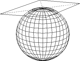
Base interface for for azimuthal (or planar) map projections.
- Since:
- 1.0
- See Also:
- Departure from OGC/ISO abstract specification:
Addition of element not in the ISO/OGC specification
This interface is not part of the ISO specification. It has been added in GeoAPI at user request, in order to provide a way to know the kind of map projection.
-
Field Summary
Fields inherited from interface CoordinateOperation
COORDINATE_OPERATION_ACCURACY_KEY, DOMAIN_OF_VALIDITY_KEY, OPERATION_VERSION_KEY, SCOPE_KEYFields inherited from interface IdentifiedObject
ALIAS_KEY, IDENTIFIERS_KEY, NAME_KEY, REMARKS_KEY -
Method Summary
Methods inherited from interface Conversion
getOperationVersion, getSourceCRS, getTargetCRSMethods inherited from interface CoordinateOperation
getCoordinateOperationAccuracy, getDomainOfValidity, getMathTransform, getScopeMethods inherited from interface IdentifiedObject
getAlias, getIdentifiers, getName, getRemarks, toWKTMethods inherited from interface SingleOperation
getMethod, getParameterValues